Postcodes
Most postcodes are small geographical areas in the UK (some are non-geographical). There are around 1,700,000 individual postcodes, which are used primarily by the Royal Mail for sorting mail for delivery to approx 23 million addresses. There are many secondary uses of postcodes, as they can be used to determine the demographics of the people who live there along with statistics for health, crime, social group and economic standing. Insurance companies used them for setting policy prices.
- How a postcode is composed
-
Postcodes are alphanumeric and are between 5 and 8 characters in length. They are made up of 2 main parts, separated by a space. The first part is known as the 'Outward code' (or Outcode) and the second part is known as the 'Inward code' (Incode).
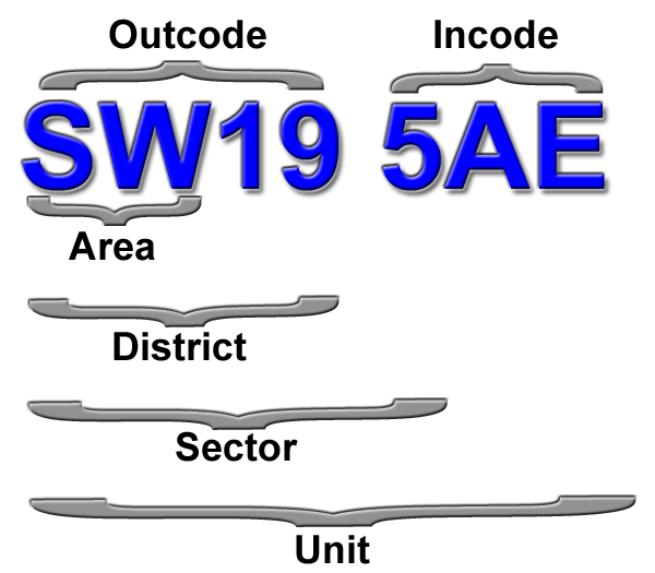
The example given above shows the varying levels of granularity such as Postal Area, District and Sector. 'Postcode Units' refer to an entire Postcode.
- Postcode Area
-
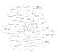
An example of an Postal Area Code is 'SW'.
There are 124 postal areas available for ploting in the system.
Postcode Area Data can be uploaded in the Summary CSV format.
- Postcode District
-
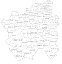
An example of a District Code is 'SW19'.
There are 2,832 postal districts available for ploting in the system.
Postcode District Data can be uploaded in the Summary CSV format.
- Postcode Sector
-
An example of a Sector Code is 'SW19 5'.
There are 9,500 postal sectors available for ploting in the system.
Postcode Sector Data can be uploaded in the Summary CSV format.
- Postcode Unit
-
This is a full UK postcode.
Postcode data can be uploaded in the 'Record Level format'.